Wednesday, March 30, 2016

Updated Wildfire Threat Analysis and More

Updated Wildfire Threat Analysis

The BC Wildfire Service recently issued an update to the Provincial Strategic Threat Analysis (PSTA), a collection of datasets that are used together to identify interface areas that may be at risk of wildfire.
Local governments, First Nations, natural resource management agencies and resource-based industries use the datasets to prioritize community wildfire protection planning, and to guide mitigation of wildfire in areas identified to be at risk. The mapping layers include vegetation types, historical wildfire data, forest fuel classification, fire behaviour patterns, geography and other factors.
The PSTA 2015 Wildfire Threat Analysis presents these relative wildfire threats at a provincial scale only. In an area where a high risk is indicated, a qualified professional should confirm the actual rating at the forest stand level.Click here for the: 2015 Wildfire Threat Analysis and associated maps . If you have a look at this map closely, you will see areas in the upper Bridge River Valley range from high to extreme and many of these are in interface zones with residential areas.
The PSTA informs the Strategic Wildfire Prevention Initiative (SWPI) and the government’s landscape fire management planning and fuel treatment programs. Fuel treatment is the process of modifying forest or rangeland fuels.
Since 2004, the SWPI has provided funding to local governments and First Nations for wildfire protection planning and fuel treatment. The SLRD has obtained funds to undertake a fuel mitigation project in and and around Gun Lake (see previous post)
While wildfire is a key process and component of ecosystems in British Columbia, the present wildfire situation in British Columbia presents challenges:
  • Continued growth of the wildland urban interface (WUI) and the expansion of infrastructure related to energy development (and other industries) on the forested landbase
  • Suppression of naturally occurring wildfires has contributed to unhealthy forest and range ecosystems and unnaturally high fuel loads
  • The effects of climate change are resulting in longer and more extreme fire seasons.

Terzaghi Dam Spill Notification
Thanks to BC Hydro for providing this information.  If you have been by on Rd. 40 downstream of Terzaghi Dam you will notice the release.   Please be careful, the river is now moving quite quickly and in one spot only metres below the road bed.   Note below on the chart that the release will almost double in volume in future periods and then gradually decrease again. 

BC Hydro definition of a Spill Release condition:
- Occurs when water is released in a controlled manner from the reservoir ("spilled") through a dam's spillway or other outlets to reduce the rate of rise inflow and water level. In so doing, the flows along the Bridge River system are expected to change.
- Considered routine operations for BC Hydro to manage reservoir levels and not an emergency event for BC Hydro.
- No flooding is anticipated but rivers may be flowing up to the tops of banks.


South Chilcotin Mountain Park Management Plan Process continues
A revised draft management plan will be released for additional public comment in the future. 

For additional information on the management planning process, please visit the BC Parks website at http://www.env.gov.bc.ca/bcparks/planning/  On this webpage, there is an RSS feed mechanism that allows users to sign up for messages regarding management planning stages.  A notice for the next stage of public input into the South Chilcotin Mountains Park will be sent out via the RSS feed mechanism upon release of the draft plan for public input. 

HIGHLINE RD. TRAVELLERS, keep an eye on this
SLRD ENGAGED IN RESPONSE PLANNING FOR ELEVATED FLOOD RISK ON ANDERSON LAKE DUE TO SPRING FRESHET


MacGillivray Pass Trail Exploratory Process

The MacGillivray Pass Trail was original constructed between 1885 and 1945 as a public highway and maintained by public expenditures.


Parts of the original road are passable now, with other parts grown over and otherwise obstructed. The original route is clearly visible.

I initiated a process aimed at addresings issues/conflicts and establishing a process/plan to revitalize this legally gazetted trail.  ,Along with the Electoral Areas  B and C we each are contributing $2,000 from our respective Select Funds (total $6,000) for initial staff time to provide support/research into the proposed plan to restore the McGillivray Pass Trail as well as potentially hire a contractor/facilitate a meeting and provide an outcomes report regarding same.

My report to the Board is here and has some good info re the trail::
https://slrd.civicweb.net/FileStorage/5ED866DE52A34DFEB2FDA996A1B2BA01-DRMcGillivray%20Pass%202016Optimized_DemareMack.pdf

Tuesday, March 22, 2016

Indigenous People and the upper Bridge River Valley

Indigenous People and the upper Bridge River Valley

I want to share this information so that the people that live and own property in the upper Bridge River Valley understand the current context of territorial claims and processes underway that potentially could impact our area.  

St'át'imc 

The St'at'imc consider the upper Bridge River Valley to be part of their territory.   The St'at'imc are not involved in the treaty process and to date, are not involved in any legal proceedings regarding their territory.

You can find more basic information on the St'at'imc at www.statimc.net.


In January, the SLRD and the St'at'imc had a community to community forum. You can see the report and follow up actions of the board at: https://slrd.civicweb.net/FileStorage/032F785EF15C4469978899E58D8025BC-C2C%20Forum%20Relationship-building%20-%20RFD.pdf

In mid-March I also attending a facilitated workshop that had considerable and elected St'at'imc representation as well as many community groups including our Bridge River Valley Community Association.  When I have the report on that I will share it with you all.

I have found both these forums very educational as we learnt the history of the St'at'imc from their perspective.  When you view the facts from their vantage, you are able to more deeply understand where we find ourselves today.  The harder question is how to move from here.  Both forums were good opportunities to ask questions and explore common issues and concerns.  

Northern Secwepemc te Qelmucw (NStQ),           

These communities are in the Treaty Process and are in the process of voting on an agreement in principle.   If it is approved, they will then move forward to negotiate the final details of the treaty.   You can find out more basic information about the NStQ at:  http://northernshuswaptribalcouncil.com/

Here is the Statement of Intent map for their treaty negotiations.

If you look carefully at the southern end of this map, you will see that it takes in signficant areas that overlap with Area A and Area B of the SLRD and of the St'at'imc identified territory.

Tsilhqot'in and the Nenqay Deni Accord

On June 26, 2014, the Supreme Court of Canada rendered a historic judgment in the Tsilhqot’in Nation’s Aboriginal title case. All 8 judges agreed with this decision. Aboriginal title declared – for the first time in Canada.

On February 11, 2016, the B.C. Government and the Tsilhqot’in Nation signed a five-year framework agreement (attached) that establishes a shared vision, principles and structures to negotiate a comprehensive and lasting reconciliation between the Nation and the Province. This agreement, named the Nenqay Deni Accord (or the “People’s Accord”), outlines 8 pillars of reconciliation to be negotiated in a holistic manner, including: 1) Tsilhqot’in Governance 2) Strong Tsilhqot’in Culture and Language 3) Healthy Children and Families 4) Healthy Communities 5) Justice 6) Education and Training 7) Tsilhqot’in Management Role for Lands and Resources in Tsilhqot’in Territory 8) Sustainable Economic Base

This is a very new and unique type of negotiation—a first of its kind in Canada. It is not a treaty, although it vaguely resembles one. The Nenqay Deni Accord (hereinafter “The Accord”, attached) is a framework for continued/ongoing – 2 – negotiation with the ‘bigger-picture’ being an outcome of ‘reconciliation’ whereby the Tsilhqot’in are redressed for all past grievances effected by the Government of British Columbia. The Accord will likely set a precedent for reconciliation with the Indigenous people

Of interest, is the map taken from the Nenqay Deni Accord.  Note that this territory is much much larger than the area the Tsilhqo'in Nation was awarded aborginal title to in the court decision.  You will also see some significant overlap with the NStQ Statement of Intent Treaty Map above.


Again, take a look at the southern end of the outlined Territory.  Portions of Area A and Area B and St'at'imc territory included in this map taken from the Nenqay Deni Accord.  

You can read "what this means"  at the SLRD staff report (it is short and clear) and the accord itself here:  https://slrd.civicweb.net/FileStorage/058B8AAA379C45C19994528D5B3F739D-Nenqay_Deni_Accord_03092016-IR.pdf

I would note that the SLRD, local government was not made aware or so far consulted on either the NStQ treaty negotiation or the Nenqay Deni Accord or the territory it maps out.   I want to assure you all that we are monitoring and asking questions.  I will keep you as informed as I can.


Monday, March 7, 2016

Budgets and Taxes

2016 Budgets for Area A

Links to budgets:
The Area A specific budgets are at this link:  https://drive.google.com/file/d/0Bz8bmBXIlkCOQ2pDVlRiN0pfR3M/view?usp=sharing
These are the services that only Area A property owners pay into or a part of Area A property owners pay into. (i.e. Bralorne Sewer is only 103 connections in the two townsites).

The entire SLRD financial plan is at this link.http://www.slrd.bc.ca/inside-slrd/notices/other-notices/draft-2016-2020-financial-plan-invitation-public-consultation   Please note this includes all services for all areas, services that combine one or more areas (called shared services) and the services that everyone pays into (General Government, Planning & Solid Waste Management).

How it all works - budgets and taxes:
The major revenue sources for regional district services include property taxes, parcel taxes and fees and charges.  In electoral areas, such as ours, regional district taxes are collected by the BC Ministry of Small Business and Revenue.  Each year, the regional district submits tax requisitions for each service to the Ministry through the Inspector of Municipalities.  The Ministry applies a rate against assessed property values within each relevant service area to raise the revenue required.  Once collected, the revenues are paid to the regional district.

Your property tax notice will list a tax rate beside each of the listed services.  The amount owing is determined by multiplying the tax rate by the property's assessed value. The challenge comes in, I have found, in that they lump a whole bunch of the services in this area together on one line, and other services they show on a single line, so you really can't see exactly what you are paying for what.  This year, for the second year, the SLRD will include a notice in your taxes that explains Area A's Tax breakdown in more detail.   I support this as it provides more transparency and accountability to the community. If you are left to try and understand the Regional District portion of your taxes from the Tax Bill, good luck.

When you do get your tax notice you will see that the vast majority of your taxes each year go to school taxes and then smaller portions to the provincial government for general services and an even smaller portion goes to the regional district. If you have any questions about your tax notice please call me and I'll walk you through the part of your taxes that relate to the Regional District.


We have a number of services in Area A.  Some of them tax everyone in the Valley for Area A services, such as the Transfer Station, Library, Museum, Economic Development, Cemetary, Haylmore Site, Amenity Preservation.  Some of them tax specific taxpayers in certain areas, Bralorne Sewer, Bralorne Water, Gold Bridge Water, Bralorne Street Lights, Gold Bridge Street Lights, Gun Lake Fire Protection, Bralorne Fire Department.  There are also some services that everyone in the Regional District (Britannia Beach to Pavilion Lake and everywhere in between) pay into such as General Government and Planning.  We also have some services that our area, Lillooet and Area B share such as the Lillooet Rescue Service and the Lillooet Landfill. 


Each of these services are taxed and MUST be managed within their own little silo.  The regional district cannot by law, move money between services.  So each is like its own little business, and also by law, none of these services can run a deficit for any length of time.  So we must tax for what it costs to run them.  Additionally, the way and process that tax requisitions can be increased is strictly controlled by the Provincial Government by the Inspector of Municipalities.  The rules around how to increase tax requisitions would blow your mind and regional district's pretty much need one staff member who is an expert on all this stuff to navigate them.  However, the long and short of it is, the rules are for your protection as a taxpayer so that you can be assured that there is a process that goes along with each and every budget increase.


Highlights Budgets and Taxes - 2016This year the total assessment for Area A is up by about 4%.  
Some highlights of this year's budgeting are (if I don't mention something its because the tax requisition, parcel taxes or user fees are staying the same):
  • the 911 service (shared) tax requisition will DECREASE (yes go down!) by almost half
  • for the first time in 4 years the Library tax requisition will go up just over $1,000. Special thanks to Jean Shaw, Betty Weaver (overall system librarian) and Regan Dixon (Area A Library Trustee) for doing such a great job with our library.  We are also going to try to find ways to assist them with small capital using funds generated by the solar grid tied system on the roof.  We do not tax requisition for the building they are in, it self generates revenue (tenants).
  • Bralorne water, Bralorne sewer and Gold Bridge water services, although I have worked to gradually increase the revenue in these services are still far from collecting enough to put away a healthy capital reserve.  You can expect to see these services to have small increases every year in tax requisitions, user fees and so on.  To help build those reserves, I have recommended to the Board that $6,500, $3,500, $5,000 respectively be committed to each of these services from the re-allocated PILT funds.
  • Lillooet Rescue Service is shared between Area A, B and Lillooet.  This year the tax requisition will increase by about $8,000.  Area B director, Mayor Lampman and myself are going to meet with this society this year to review in detail their operations and their future plans.
  • The services that everyone in the SLRD pays into General Government has no increase , while the planning service has a very small increase in tax requisition.
Everything else is pretty much the same.

If you have any questions or comments please email me or give me a call in the next week.


Recognizing Russ Oakley - Area A Director for 15 years
Russ Oakley is the type of person I want to highlight as an example of the people who live in our area. Hard working, resilient, determined and honest. You may not always agree with an elected official, however you cannot deny their service and character. Thank you Russ for your service to our community.


The Squamish-Lillooet Regional District Board has supported my efforts to recognize the service of Russ Oakley both to our community and the entire Regional District.


Simon vs. the United States
On July 30, 2015, Bruce Simon, Bralorne Resident and business owner of Sally's Pub and The Mines Motel was arrested for transporting marijuana and MDMA into the United States.  Bruce was indicted on August 26 and denied bail.

Bruce initially pled non-guilty. However he changed his plea to guilty on November 3, 2015.

On February 19, 2016, Bruce was sentenced to 4-1/2 years in prison.

Sally's Pub and The Mines Motel is currently for sale.  Sally's Pub is closed.  The Mines Motel remains open.

I have included some key COURT documents from Washington State in roughly chronological order. They are not difficult to read or understand.


Complaint:  https://drive.google.com/file/d/0Bz8bmBXIlkCOY0JJNlAtVnhYeFE/view?usp=sharing


Indictment:  https://drive.google.com/file/d/0Bz8bmBXIlkCOcmhjU25tRUtlT2s/view?usp=sharing


Defendant's Memorandum at Bail Hearing - includes support letters  https://drive.google.com/file/d/0Bz8bmBXIlkCOODhFUWo5Q2RtQlU/view?usp=sharing

Plea Agreement:  https://drive.google.com/file/d/0Bz8bmBXIlkCOeERWdGlPWXRBcXc/view?usp=sharing

United States sentencing document:  https://drive.google.com/file/d/0Bz8bmBXIlkCOSnlmaXVMb1h5Nmc/view?usp=sharing


Defendent sentencing document:

https://drive.google.com/file/d/0Bz8bmBXIlkCOYUF6VmUtclRZX0k/view?usp=sharing

Defendent sentencing Support documents (letters of support from Bralorne community members, friends and family) :  https://drive.google.com/file/d/0Bz8bmBXIlkCOUFYyNUlWWmVWSDg/view?usp=sharing


Bralorne Sewer
If you missed all the hullabaloo about the funding announcement for the Bralorne Sewer you can find it here:  http://www.debbiedemare.com/2016/02/cue-happy-dance-bralorne-sewer-system.html.  Sewers are a local government responsibility (i.e. SLRD).  I have had some folks wonder why improvements in the roads were not funded. Roads are a provincial responsibility - the person you need to bug about the roads is Jackie Tegart your MLA. ( http://jackietegartmla.ca/contact/)  BELIEVE ME :-) if I, as your local government rep had any control over funding/budgets going to roads, there would be improvements in both maintenance, safety & infrastructure improvements of our two access routes - Road 40 & the Hurley River FSR.  Report after report, person after person indicates our road access hampers our ability to sustain ourselves as a community.

I digress.  The SLRD staff have also send out an information letter to residents of Bralorne and everyone that receives mail here in the Valley..  If you did not receive it, you can read it here:  https://drive.google.com/file/d/0Bz8bmBXIlkCOam53eE1DeVJqYm8/view?usp=sharing

A lot of work goes into communicating about big news.  Here is what our staff did at the SLRD on our behalf:
*         Press release sent out on Friday 12 Feb, after the announcement
*         Facebook and twitter posts announcing grant and linking to our news release. (That reached 3216 people, inspired 412 clicks, and 96 likes, comments and shares as of February 19)
*         Mail sent to residents (attached letter)
o   132 copies of letter sent as unaddressed mail to Gold Bridge PO
o   75 copies sent via direct mail today to property owners who, according to BC Assessment Roll, had mailing address outside Bralorne

This is such positive news for the future of Bralorne, I want to express my thanks and highlight  our SLRD Communications and Utilities staff.  They do a great job for our rural community!


Friday, February 12, 2016

Cue the Happy Dance, Bralorne Sewer System Funded

Winterfest was fantastic!

Thank you to the BRVCA, its Staff Jane & Jenny, the countless and committed volunteers, and all of the sponsors from our local businesses and many of the Lillooet business.  See the list here: www.bridgerivervalley.ca/winterfest/


Photo courtesy of Ina Hunt, a visitor who came for Winterfest!  Ya!

This Winterfest was the 7th.  And it was SO MUCH FUN!!   If you couldn't make it this year, mark Family Day weekend in 2017 and be sure not to miss it!


Cue the Happy Dance, Bralorne Sewer System Funded

Cue the sound of a Happy Dance being danced up and down the Regional District…

I am pleased to share the news that the SLRD has been granted $1,999,530 from Canada’s Gas Tax – Strategic Priorities Fund, to replace Bralorne’s 90 year old sanitary sewer system.

The SLRD is one of 57 communities, out of 222 applicants, to receive support in 2016 from the fund.

Minister Amarjeet Sohi just announced the allocations.

The news release, with other background info and the accompanying release from the Government of Canada, is also posted to our website: http://www.slrd.bc.ca/inside-slrd/news-events/news-slrd-receives-2-million-grant-new-bralorne-wastewater-treatment-system


Huge thanks to the entire SLRD board who supported this application as the TOP and ONLY application from our Regional District.  Also to the SLRD Utilities and Communications staff who did this proposal that obviously technically scored so that we received this grant!  So awesome folks!!   

And finally, thanks to the Federal Government for creating the Gas Tax funding system and showing that it can work for all types of communities in Canada, from the biggest cities to the smallest such as Bralorne.  We may be small but we are THE most spectacularly beautiful and most amazing (and affordable) place to live.

Want to know why this is so critical?  Read my previous posts (about 1/2 way down) on the topic:  http://www.debbiedemare.com/2014/10/results-hurley-river-rd-survey-more.html


$99k Awarded to SLRD for Phase 2, Fuel Mitigation Work around Gun Lake

I am very pleased to advise that a second round of Fuel Mitigation work has been funded.
$99k from the Strategic Wildfire Initiative (Provincial) and $10k from SLRD Area A Select Funds.

Fuel Mitigation completed at the south end of Gun Lake
Fuel mitigation involves thinning, lower limb removal and ground debris removal to provide few available ladder fuels in the event of a forest fire.  You can see the first phase of this work in and around the south end of Gun Lake.  Kind of looks parklike.


NORTHERN ST’ÁT’IMC, DISTRICT OF LILLOOET AND SQUAMISH-LILLOOET REGIONAL DISTRICT TAKE STEPS TOWARD STRONGER RELATIONSHIPS

On Thursday, January 21 and Friday, January 22, the Chiefs and several
councillors from the six northern St’át’imc communities met for a Community to Community(C2C) Forum with several directors of the Squamish-Lillooet Regional District (SLRD) Boardand the District of Lillooet Mayor and Council to share learning and explore ways that the organizations might work more collaboratively. Each of the organizations contributed staff resources to plan and deliver the event, with partial funding being provided through a C2C grant from the Union of BC Municipalities and the balance of the costs being contributed by the SLRD. The Forum, which was facilitated by EcoPlan International, took place in the St’át’imc community of Xwísten, near Lillooet.


I will keep you all up to speed as the relationship building between the SLRD (your local government) and the Norther St'at'imc continues.

Our Favorite Topic:  The Hurley
Wondering about the Hurley and how soon it might be open this year?

This picture, taken by Ray Mason at end of January gives you a visual.  This is the sign at the summit, buried that someone has run over & managed to bend.


First point, if you're sledding on these roads watch out for the signs!

Backcountry Snowcats  groom the Hurley frequently and that whittles a little off the top, but it looks like we're going to have an average (i.e. lots of snow) year on the Hurley. By the way, the sign will be replaced in the spring with a 10 ft version.

Finally, do not drive up the Hurley just because it looks hard packed.    You will get stuck. Sledders on the road report back regularly about, and I'm sorry no other word for it, the idiots who drive up there, and yes, get stuck.  

E-Value BC
BC Assessment has come up with an easy to use and very useful online tool to get property value information, property sales in the area and also to compare your property with neighboring property assessments.

Give it a try:  http://evaluebc.bcassessment.ca/

Limey John Garrett

John Garrett, a war vet and very long time resident of the Bridge River Valley passed away recently.  On behalf of all the property owners and residents of the Bridge River Valley I expressed the following ...

On behalf of all the residents and property owners of the Bridge River Valley, I send my condolences to the family and friends of John Garrett. I would also like to express sympathy and thanks to John's caregivers, your steadfast friendship along with care, allowed John to live out his his days in Bralorne.

The Bridge River Valley was John's home. And while I did not know Mr. Garrett personally I do understand his love and commitment to this Valley which he demonstrated by his choices in his life. 

God bless you John Garrett, a life well lived.  May you rest in peace in this beautiful spot.

Debbie DeMare
Electoral Area Director,
Squamish Lillooet Regional District  


Sunday, January 17, 2016

Tyaughton Lake/Gun Creek Rd. : Two Issues

No Firearms Discharge Bylaw

Updated:  June 16, 2016
Based on input from residents, the original proposed map has been modified.
These  original buffers were 800m around the habituated areas on Gun Creek Road, as well as 800m around Tyaughton Lake. Using the input, the staff have extended the buffer along the unnamed Tyaughton Lake Road on the easterly portion of the lake. The buffer follows this road and then extends up and around the northerly end of the lake, encapsulating the Tyax resort parcels. For clarity the staff have refined the polygon to be one solid area now instead of the two individual overlapping buffers. As for a map title please note this is temporarily labeled it as "Schedule X"


Here is the revised updated map: https://drive.google.com/file/d/0Bz8bmBXIlkCOVmkxNmdnRkJqNXc/view?usp=sharing

Please get back to me directly at demare87@gmail.com (or call me) by July 15 with any further input or comments.

=========================================================

This fall residents in the Tyaughton Lake and Gun Creek Rd. had repeated issues with firearms discharges in the very immediate vicinity of their properties.  These incidents involved a variety of circumstances including illegal hunting practices.

I have had several requests from residents of both Tyaughton Lake and Gun Creek Rd. to extend the current Area A No Firearms Discharge Bylaw.    While, in the case of hunting, there is a mechanism to report the offence, the addition of a local government bylaw allows an additional level of safety to residents, by saying no discharge of firearms.  

Residents could submit a complaint to the SLRD staff, the bylaw enforcement officer would investigate and a fine or ticket could be issued.


Have a read of these links:
Current No Firearms Discharge Bylaw  You will note that there are a number of exemptions and permissions.  The fines are a minimum of $500/day.  Area D (Rural Squamish/Whistler, Britannia Beach) also have a No Firearms Discharge Bylaw.

Map of proposed boundary around Tyaughton Lake & Gun Creek Rd.   The boundary is basically 800 m from the back property line.  This is proposed and could be changed, but is judged to be safe distance from private property.

I have put together a little survey to get your opinion on this.  You can also send me an email or call me.  Click here to do the survey:  https://www.surveymonkey.com/r/ZWCVJ38


Tyax Resort submits new application that requires an OCP Amendment and Rezoning

Tyax Real Estate originally applied to rezone the main lodge property (now subject to this application) and another property down the street (Lot 5, DL 4931, Plan KAP67637, LLD) for staff accommodation purposes in spring 2014. That application was brought forward to both the EAD and the Board.  As the application proceeded, it was amended to apply to one parcel only – Lot 5, located to the west and south of the main lodge site.  The OCP and Zoning amendment bylaws associated with Lot 5 were adopted in July 2014.  

The SLRD has now received an application for a rezoning and OCP amendment regarding the Tyax Lodge property noted above.  A portion of that lot (Site A) as shown in the maps in Appendix 1 is where the main lodge and proposed facilities are located.  The amendment application requests a zoning amendment to allow a facility that would jointly house staff accommodation and helicopter operations uses.  A dormitory style building is proposed for the main Tyax Lodge property along with office and storage uses related to the helicopter operations at Site A.   


You can read the full report/maps etc here:  https://slrd.civicweb.net/FileStorage/DD334A9CF5A5421784216D97457DE51A-RFD-160113%20Tyax%20Real%20Estate.pdf 

This report will go to the SLRD Board meeting January 27 requesting direction to the staff to prepare the OCP amendment and zoning documents.   If this is the direction given by the board, those documents would likely come back to the board in February or March for 1st Reading.  Following that there would be an official opportunity for input (letters, public hearing etc.)

I am providing the residents of the area advance notice and an opportunity to email or phone me with your thoughts on this.  My email is demare87@gmail.com or (250)238-2248.

Posts on my blog from previous OCP/Rezoning applications from Tyax Resort:
http://www.debbiedemare.com/2014/04/tyaughton-lake-gun-creek-neighborhood.html


http://www.debbiedemare.com/2014/05/tyax-wilderness-resort-rezoning-other.html

http://www.debbiedemare.com/2014_06_01_archive.html


Monday, January 4, 2016

A very Happy New Year to everyone!  I hope your holiday season was restful and full of fun.  Winter is full blown here in the Bridge River Valley and everyone has been out doing everything and anything winter.   


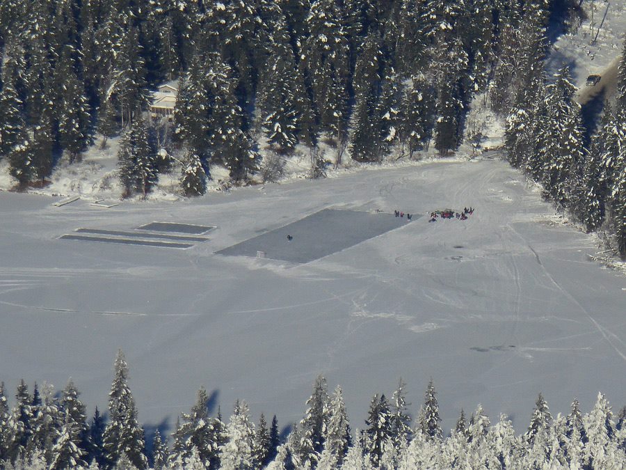
We are also already getting ready for Winterfest, February 6 & 7 (Family Day weekend).    Why not round up a whole bunch of your friends and family and come up for two days of super super winter fun!

Photo courtesy: SouthChilcotin.ca

The rinks at Little Gun Lake are already made and being used.  Be sure not to miss this awesome family oriented event in the Bridge River Valley.


Our favorite topic:  TheHurley River Rd. (FSR)


The weather has been fantastic for everything Winter in the Bridge River Valley.  Thanks to Ray Mason, Totally Awesome Adventures for this great shot showing the sign (or buried sign) at the summit of the Hurley.
We have had some incidents of folks attempting to drive in trucks up the road.  In places and at times its pounded down pretty good by the sleds, however YOU WILL GET STUCK eventually.  Please don't do it!!!


The statistics for the driving season are in from 2015.  From mid-May to mid-October the road averaged 91 total trips per day, with such big spikes on the May long weekend (270 on one day) and September long weekend (400 on one day).


Did you get a "special"(never good) letter from BC Assessment?
Did you get a special letter from BC Assessment that looks like this in late November or early December?  This is not the normal Notice of Assessment - but a special letter.   (The top has been chopped off to protect the owner's privacy).  If you did can you let me know.


Crimestoppers covers our area

At a recent SLRD Board meeting, representatives from the Kamloops and area Crimestoppers attended.  It turns out they cover our area.  Mark Price, their coordinator has donated two signs (watch for them this spring) and lots of "swag" with Crimestopper's phone number on them.


We all associate CrimeStoppers with reporting - anonymously - crime that happens around us.  This is how it works:  http://www.kamloopscrimestoppers.ca/giving-information/

Most of us don't realize that you can also report all types of Natural Resource Violations anonymously through Crime Stoppers: Natural Resource Violations may include illegal or unauthorized activities related to:
  • development or use of Crown land
  • forestry operations
  • aggregate extraction
  • use of water (or works in and about water)
  • use of fire in forests or on grasslands
  • culturally sensitive sites and artifacts
  • forest service roads
  • use of off-road vehicles
  • habitat damage
  • forest recreation sites and trails
  • Crown pastures and associated livestock
Click here for more information:  https://www.for.gov.bc.ca/hen/crime.htm


And...while we are on the topic of Natural Resource Violations...

A report can also be directly submitted using  a Report of Natural Resource Violation form or call the Natural Resource Violation reporting line at 1 844 NRO-TIPS (1 844 676-8477)

Lots more information here:  https://www.for.gov.bc.ca/hen/nrv/


Wednesday, October 21, 2015

Proposed Motorized Vehicle Closures - Shulaps (and more).

Proposed Motorized Vehicle Closures - Shulaps

 UPDATE: Public Engagement Websites Now Live:

 Shulaps:


Cayoosh:

http://apps.nrs.gov.bc.ca/pub/ahte/hunting/cayoosh-alpine-motor-vehicle-closure


UPDATE - November 20.  Bridge River Lillooet News Article -Click Here: Ministry Criticized


      UPDATE - November 18.  I have followed up with the Ministry and the public engagement for these proposed closure is not yet ready, although it sounds like it is getting closer.  I have this "bookmarked" folks and will follow up again in a week or so.

UPDATE - October 26.  Thanks to the MLA's office & the Ministry officials, the process here I think a bit clearer.  Apparently there will be a public engagement website up by November 15.
      Which means a November 1 deadline really isn't applicable.   The Ministry had send out notifications to stakeholders (clubs etc) first.  I have provided my suggestions that it might be better to establish the public website first and then send out letters to stakeholders.  I have also suggested going forward, the Ministry may want to use the Regional Districts as a sustainable, up to date way to get in touch with local areas such as ours. By necessity their contacts are generally up to date and at a minimum they can forward to Electoral Area Directors & Municipalities.   I will stay in touch everyone.

UPDATE:  The Ministry has extended the timeframe for comments to November 1.  They are working on a weblink however for now comment may be emailed to Frances.Iredale@gov.bc.ca.

     The Ministry of Forests, Lands and Natural Resource Operations is seeking input  with respect to proposed Alpine Motor Vehicle Wildlife Act closures within the Cayoosh and Shulaps Mountain Range. These closures will apply to all motorized vehicles. Under the Wildlife Act Motor Vehicle Prohibition Regulation a motor vehicle is defined as:
     motor vehicle" means a device in, on or by which a person or thing is being or may be transported or drawn, and which is designed to be self-propelled, and includes an atv or snowmobile, but does not include
     (a) a device designed to be moved by human, animal or wind power,
     (b) a device designed to be used exclusively on stationary rails or stationary tracks, or
     (c) a boat propelled by motorized power;

     These closures will apply year round at the 1,920 meter elevation (approximately 6,300 feet). These closures are identical to adjacent existing closures under the Wildlife Act such as Nine Mile, Hogback Mountain.

     More information on existing closures under the Wildlife Act Motor Vehicle Prohibition Regulation can be found here: http://www.bclaws.ca/Recon/document/ID/freeside/474756515

     These closures are required to protect and conserve important alpine habitat and regionally important wildlife. Please refer to the table below that outlines wildlife values these closures will conserve and protect.

Species or Habitat
Conservation Status
Value
Wildlife Act Closure
Grizzly Bear
Threatened Population
Spring Habitat, Whitebark pine
Shulaps , Cayoosh
Mountain Goat
Species of concern
Winter and Kidding Habitats
Cayoosh, Shulaps
California Sheep
Species of concern
Alpine Winter Habitat
Shulaps
Whitebark Pine
Threatened species of concern
Important fall food for Grizzly bear
Shulaps, Cayoosh
Mule Deer
Secure not at risk
Summer foraging habitat
Shulaps, Cayoosh
Wolverine
Species of concern
Denning habitat
Shulaps, Cayoosh

      The map below can be used as reference that will assist you with respect to providing any comments that you may have. 

     You have to Friday October 23rd, 2015. For your respective club members you can also comment through the hunting and trapping public advisory website: http://apps.nrs.gov.bc.ca/pub/ahte/  Proposed regulations will be posted here shortly.

     You can also email saldemare@gmail.com comments (he is the BRVCA Trails Committee chair) or myself.


Interesting Bridge River Valley Statistics

Bridge River Valley Only
     Full-time residents - 224 per 2011 census

     Estimated part-time residents - 1,783 (#of residential folios with a non-BRV mailing address x         average family size in BC per census)

     Ratio of part-time property owners: full-time residents: 8:1

Bridge River Valley vs. Entire SLRD
The BRV has less than 1% of the full-time resident population of the SLRD

But has 36% of the total number of property folios and 28% of all folio value

Expenses allocated to the BRV represent 4.2% of the SLRD budget


2016 Fire Smart Program

The 2016  FireSmart grant program provides funding to local governments and First Nations in BC to support residents to undertake FireSmart planning activities for private lands, as identified by Partners in Protection through the FireSmart Communities Program, and/or to develop or advance local planning efforts to mitigate risk from wildfire on private lands in the wildland urban interface.

The intent of the 2016 FireSmart grant program is to enable First Nations or resident or community groups within a local government to take the required actions in order to achieve and/or maintain FireSmart Community Recognition status from Partners in Protection.

The SLRD has access to a grant of $10,000 total and we are applying for it for 2016.  The four electoral areas have not yet figured out how to divide this up between us.  I am asking you as property owners to put your thinking caps on and let me know how this funding should be used to assist in getting our private properties Fire Smarted.

What is the Fire Smart Program:  https://www.firesmartcanada.ca/what-is-firesmart

What are your ideas for how best to utilize these funds?  https://www.surveymonkey.com/r/LS3PLLF