No Firearms Discharge Bylaw
Updated: June 16, 2016
Based on input from residents, the original proposed map has been modified.
These original buffers were 800m around the habituated areas on Gun Creek Road, as well as
800m around Tyaughton Lake. Using the input, the staff have extended the buffer along the
unnamed Tyaughton Lake Road on the easterly portion of the lake. The buffer
follows this road and then extends up and around the northerly end of the lake,
encapsulating the Tyax resort parcels. For clarity the staff have refined the polygon to
be one solid area now instead of the two individual overlapping buffers. As for
a map title please note this is temporarily labeled it as "Schedule X"
Here is the revised updated map: https://drive.google.com/file/d/0Bz8bmBXIlkCOVmkxNmdnRkJqNXc/view?usp=sharing
Please get back to me directly at demare87@gmail.com (or call me) by July 15 with any further input or comments.
=========================================================
This fall residents in the Tyaughton Lake and Gun Creek Rd. had repeated issues with firearms discharges in the very immediate vicinity of their properties. These incidents involved a variety of circumstances including illegal hunting practices.
I have had several requests from residents of both Tyaughton Lake and Gun Creek Rd. to extend the current Area A No Firearms Discharge Bylaw. While, in the case of hunting, there is a mechanism to report the offence, the addition of a local government bylaw allows an additional level of safety to residents, by saying no discharge of firearms.
Residents could submit a complaint to the SLRD staff, the bylaw enforcement officer would investigate and a fine or ticket could be issued.
Have a read of these links:
Current No Firearms Discharge Bylaw You will note that there are a number of exemptions and permissions. The fines are a minimum of $500/day. Area D (Rural Squamish/Whistler, Britannia Beach) also have a No Firearms Discharge Bylaw.
Map of proposed boundary around Tyaughton Lake & Gun Creek Rd. The boundary is basically 800 m from the back property line. This is proposed and could be changed, but is judged to be safe distance from private property.
I have put together a little survey to get your opinion on this. You can also send me an email or call me. Click here to do the survey: https://www.surveymonkey.com/r/ZWCVJ38
Tyax Resort submits new application that requires an OCP Amendment and Rezoning
Tyax Real Estate originally applied to rezone the main lodge property (now subject to this application)
and another property down the street (Lot 5, DL 4931, Plan KAP67637, LLD) for staff accommodation
purposes in spring 2014. That application was brought forward to both the EAD and the Board. As the
application proceeded, it was amended to apply to one parcel only – Lot 5, located to the west and
south of the main lodge site. The OCP and Zoning amendment bylaws associated with Lot 5 were
adopted in July 2014.
The SLRD has now received an application for a rezoning and OCP amendment regarding the Tyax Lodge property
noted above. A portion of that lot (Site A) as shown in the maps in Appendix 1 is where the main lodge
and proposed facilities are located. The amendment application requests a zoning amendment to allow
a facility that would jointly house staff accommodation and helicopter operations uses. A dormitory
style building is proposed for the main Tyax Lodge property along with office and storage uses related to
the helicopter operations at Site A.
You can read the full report/maps etc here: https://slrd.civicweb.net/FileStorage/DD334A9CF5A5421784216D97457DE51A-RFD-160113%20Tyax%20Real%20Estate.pdf
This report will go to the SLRD Board meeting January 27 requesting direction to the staff to prepare the OCP amendment and zoning documents. If this is the direction given by the board, those documents would likely come back to the board in February or March for 1st Reading. Following that there would be an official opportunity for input (letters, public hearing etc.)
I am providing the residents of the area advance notice and an opportunity to email or phone me with your thoughts on this. My email is demare87@gmail.com or (250)238-2248.
Posts on my blog from previous OCP/Rezoning applications from Tyax Resort:
http://www.debbiedemare.com/2014/04/tyaughton-lake-gun-creek-neighborhood.html
http://www.debbiedemare.com/2014/05/tyax-wilderness-resort-rezoning-other.html
http://www.debbiedemare.com/2014_06_01_archive.html
Sunday, January 17, 2016
Monday, January 4, 2016
A very Happy New Year to everyone! I hope your holiday season was restful and full of fun. Winter is full blown here in the Bridge River Valley and everyone has been out doing everything and anything winter.
 We are also already getting ready for Winterfest, February 6 & 7 (Family Day weekend). Why not round up a whole bunch of your friends and family and come up for two days of super super winter fun!
Photo courtesy: SouthChilcotin.ca
The rinks at Little Gun Lake are already made and being used. Be sure not to miss this awesome family oriented event in the Bridge River Valley.
Our favorite topic: TheHurley River Rd. (FSR)
The weather has been fantastic for everything Winter in the Bridge River Valley. Thanks to Ray Mason, Totally Awesome Adventures for this great shot showing the sign (or buried sign) at the summit of the Hurley.
 We have had some incidents of folks attempting to drive in trucks up the road. In places and at times its pounded down pretty good by the sleds, however YOU WILL GET STUCK eventually. Please don't do it!!!
The statistics for the driving season are in from 2015. From mid-May to mid-October the road averaged 91 total trips per day, with such big spikes on the May long weekend (270 on one day) and September long weekend (400 on one day).
Did you get a "special"(never good) letter from BC Assessment?
Did you get a special letter from BC Assessment that looks like this in late November or early December? This is not the normal Notice of Assessment - but a special letter. (The top has been chopped off to protect the owner's privacy). If you did can you let me know.

Crimestoppers covers our area
At a recent SLRD Board meeting, representatives from the Kamloops and area Crimestoppers attended. It turns out they cover our area. Mark Price, their coordinator has donated two signs (watch for them this spring) and lots of "swag" with Crimestopper's phone number on them.

We all associate CrimeStoppers with reporting - anonymously - crime that happens around us. This is how it works: http://www.kamloopscrimestoppers.ca/giving-information/
Most of us don't realize that you can also report all types of Natural Resource Violations anonymously through Crime Stoppers: Natural Resource Violations may include illegal or unauthorized activities related to:
And...while we are on the topic of Natural Resource Violations...
A report can also be directly submitted using a Report of Natural Resource Violation form or call the Natural Resource Violation reporting line at 1 844 NRO-TIPS (1 844 676-8477)
Lots more information here: https://www.for.gov.bc.ca/hen/nrv/
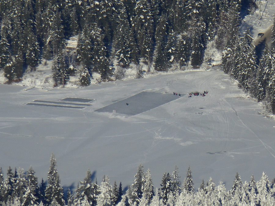
Photo courtesy: SouthChilcotin.ca
The rinks at Little Gun Lake are already made and being used. Be sure not to miss this awesome family oriented event in the Bridge River Valley.
Our favorite topic: TheHurley River Rd. (FSR)
The weather has been fantastic for everything Winter in the Bridge River Valley. Thanks to Ray Mason, Totally Awesome Adventures for this great shot showing the sign (or buried sign) at the summit of the Hurley.

The statistics for the driving season are in from 2015. From mid-May to mid-October the road averaged 91 total trips per day, with such big spikes on the May long weekend (270 on one day) and September long weekend (400 on one day).
Did you get a "special"(never good) letter from BC Assessment?
Did you get a special letter from BC Assessment that looks like this in late November or early December? This is not the normal Notice of Assessment - but a special letter. (The top has been chopped off to protect the owner's privacy). If you did can you let me know.

Crimestoppers covers our area
At a recent SLRD Board meeting, representatives from the Kamloops and area Crimestoppers attended. It turns out they cover our area. Mark Price, their coordinator has donated two signs (watch for them this spring) and lots of "swag" with Crimestopper's phone number on them.

We all associate CrimeStoppers with reporting - anonymously - crime that happens around us. This is how it works: http://www.kamloopscrimestoppers.ca/giving-information/
Most of us don't realize that you can also report all types of Natural Resource Violations anonymously through Crime Stoppers: Natural Resource Violations may include illegal or unauthorized activities related to:
- development or use of Crown land
- forestry operations
- aggregate extraction
- use of water (or works in and about water)
- use of fire in forests or on grasslands
- culturally sensitive sites and artifacts
- forest service roads
- use of off-road vehicles
- habitat damage
- forest recreation sites and trails
- Crown pastures and associated livestock
And...while we are on the topic of Natural Resource Violations...
A report can also be directly submitted using a Report of Natural Resource Violation form or call the Natural Resource Violation reporting line at 1 844 NRO-TIPS (1 844 676-8477)
Lots more information here: https://www.for.gov.bc.ca/hen/nrv/
Subscribe to:
Posts (Atom)

